Services
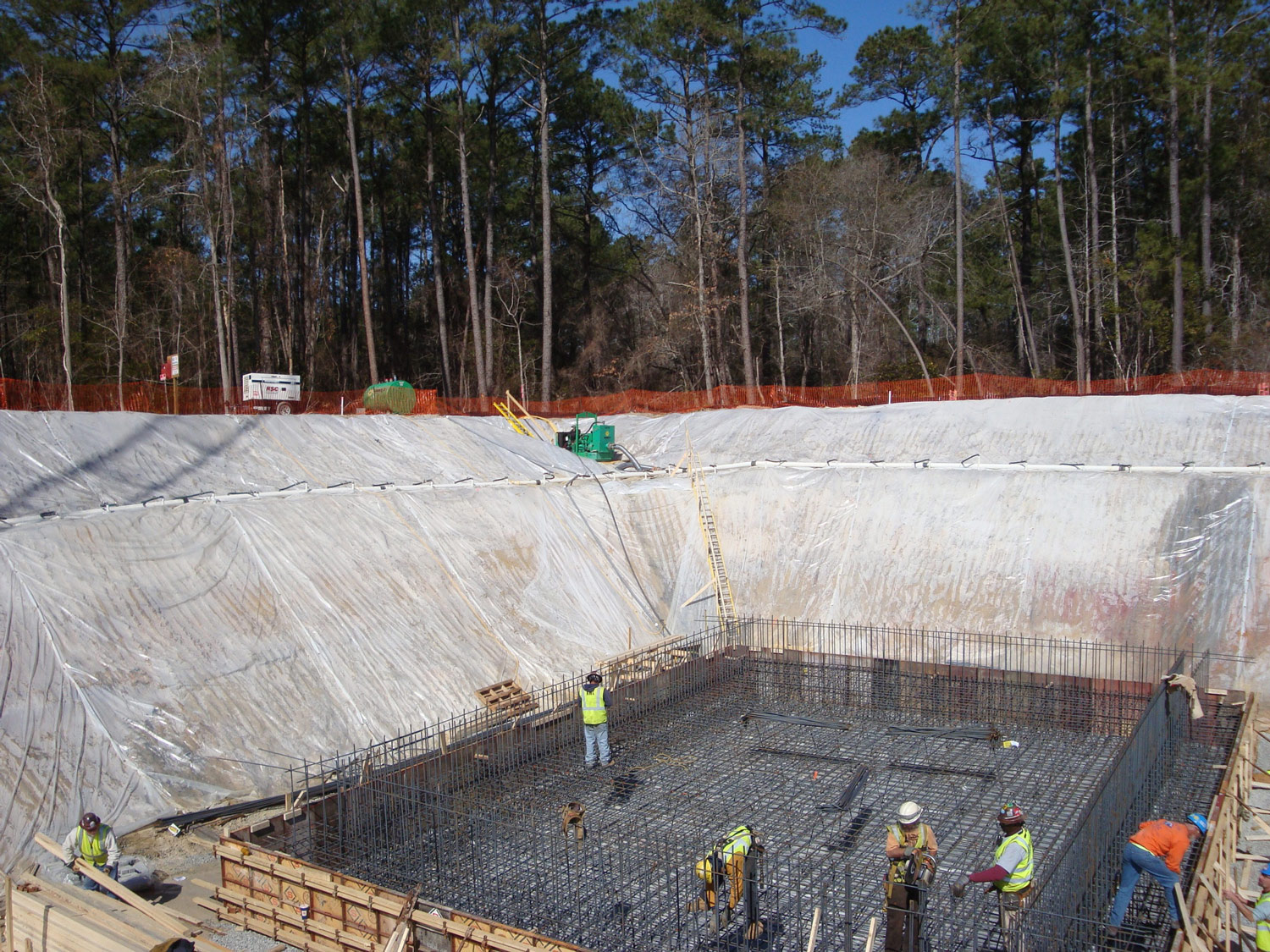
Site Engineering
Site Engineering
Our site engineering projects include a wide variety, such as the site layouts, surveys and civil designs of an exclusive 14-lot waterfront subdivision; the Union Mission Ministries campus in Norfolk that serves the homeless community; the small community church in Virginia Beach; and the 56-acre Veterans Administration Hospital in Orlando.
Feasibility Studies
A civil engineering feasibility study is a critical process used to evaluate the viability of a proposed construction project. Bamforth’s civil engineers assess site conditions, including topography and soil, to ensure the location is suitable for the project. They conduct technical analyses, considering factors such as infrastructure needs and material selection. Environmental impacts, regulatory compliance, and risk assessments are key areas we focus on to mitigate potential challenges. Finally, Bamforth’s team provides cost estimates and conceptual designs, ensuring the project meets budgetary and regulatory requirements while being technically feasible.
Surveying
Surveying
Bamforth’s staff of four licensed surveyors provides elevation certificates, boundaries, monument establishment, survey-grade GIS location of structures and facilities, and both foreign and domestic topographic surveys. Our wide array of equipment includes GPS, survey-grade GIS, in addition to conventional surveying equipment and techniques.
Potable Water
Potable Water
Bamforth has designed numerous water projects such as treatment facilities, freshwater wells, elevated storage tanks, neighborhood transmission and distribution systems, and site water mains in a myriad of locations and terrains throughout the world.
Wastewater
Wastewater
Many of our nation’s wastewater systems are nearing their individual capacities at the same time that they have already functioned well past their useful life expectancy; available pipe installation corridors and replacement budgets are also shrinking in size. Bamforth’s engineers creatively find a way to meet regulatory requirements, as we enhance the integrity of your treatment facilities, pump stations and infrastructure.
Stormwater
Stormwater
As our communities and infrastructure are further developed and re-developed, Bamforth believes that it is critically important to continually consider the preservation of our natural resources and habitats. Achieving familiarity, professional experience and expertise with enhanced local, state and federal regulations and ever-changing products and permitting procedures requires our constant, willful and intentional effort. Towards that end, Bamforth mixes creative solutions, married with sound science and time proven methods to improve water quality and runoff reduction that meets or exceeds regulatory requirements within budgets.


DoD Airfield Pavements
DoD Airfield Pavements
Whether the airfield is in Virginia, North Carolina or overseas, our nation’s security and military readiness depends on the quality and availability of the military airfields. Bamforth’s experienced staff of engineers and surveyors are providing reliable DoD airfield pavement improvement designs that help keep our nation’s aircraft ready to serve.
Landfills
Landfills
Our multi-phased landfill designs, leachate management systems, cell caps, recycling centers, and QA/QC construction services help to effectively balance the vast solid waste stream of a facility or installation, while protecting the environment.
Recreation
Recreation
It is heart-warming to watch the smiles of young student athletes as they set foot on a brand new NCAA compliant athletic field. Bamforth takes great pride in providing the designs that convert old, worn-out, patchy grass athletic fields into safe, state-of-the-art athletic facilities and complexes. Our designs include fields for baseball, field hockey, football, lacrosse, soccer, softball and track.


Mapping
Mapping
A complete and accurate facility map in GIS or CADD format is critical to owners, designers and planners, particularly for MS-4 permits. Bamforth has a history of producing thorough and complete maps of utility records from the small intricately detailed intersection drawing, to the complicated large military facility drainage systems of more than 6000 structures.
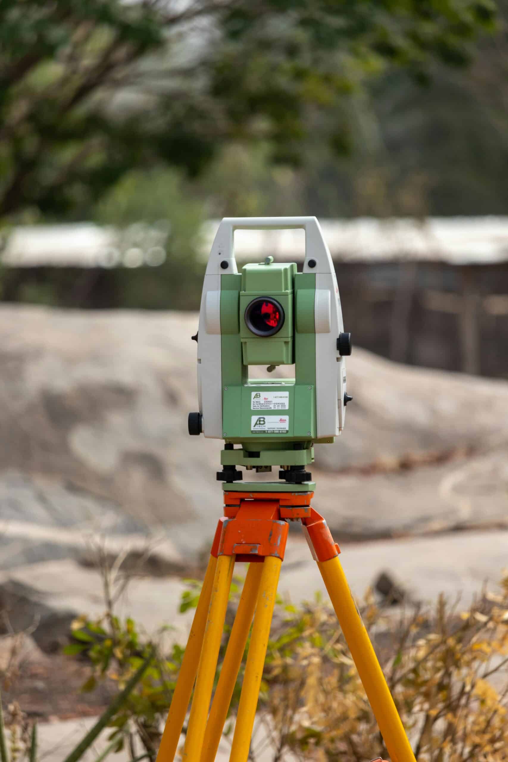
Technology
Like a skilled carpenter needing quality tools to produce a quality product, the professional seeks out the best technologies to augment their deliverables. Bamforth primarily utilizes Leica surveying equipment, including robotic Total Stations and GPS units. We collect survey-grade GIS data using the Leica ZENO and the latest version of ArcGIS.
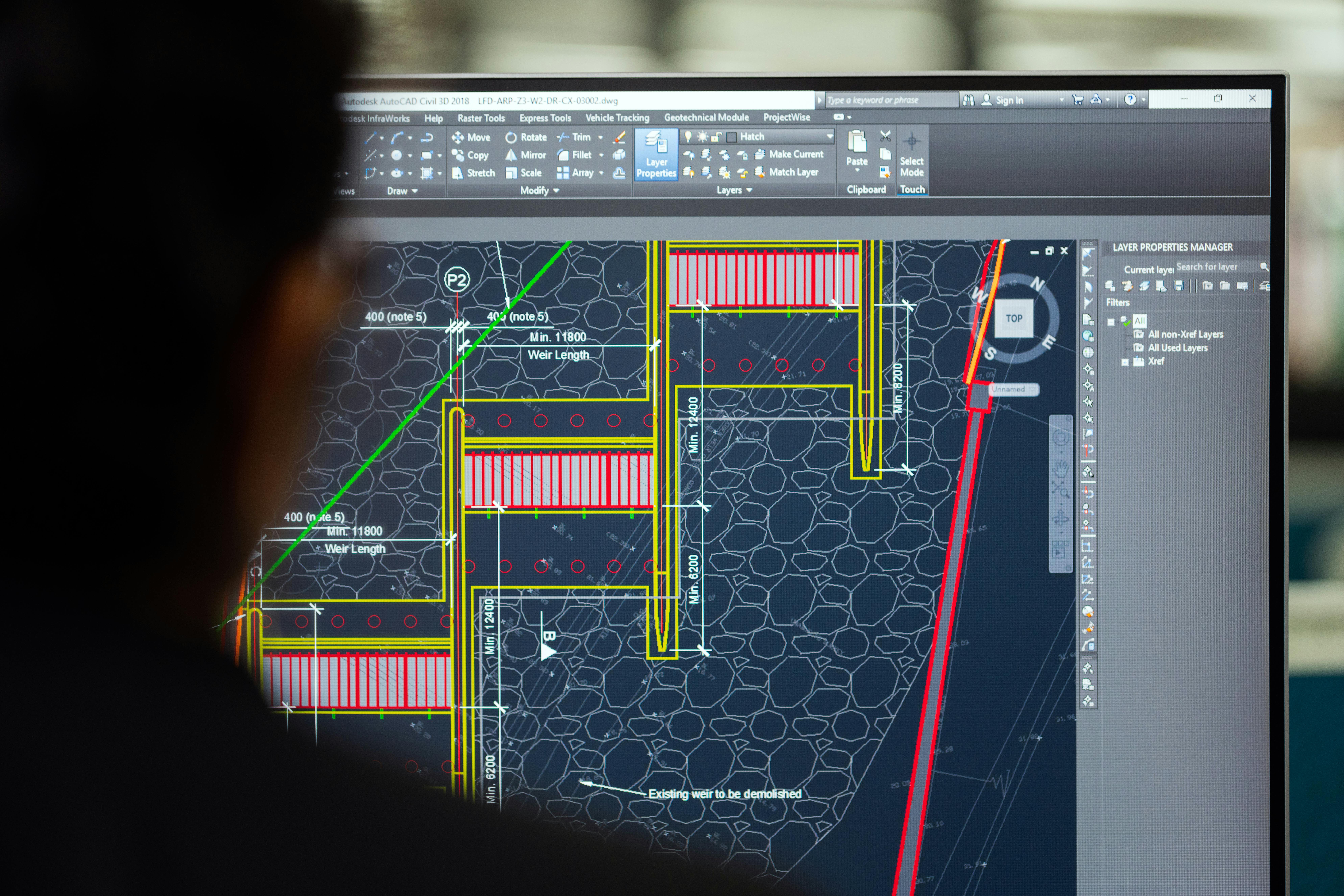

Our technicians produce drawings using the latest version of AutoCAD Civil 3D to model existing and proposed surfaces and utilities; these are coordinated with BIM/RVIT. We use numerous software products to assist with our design analysis such as KYPipe, WaterGems, HydraCAD HydraFlow, EPA SWMM, and PCASE. Bamforth has in-house capabilities to provide specifications in SpecsIntact, Specpoint, and Masterspec formats; the ability to create .pdf files; and cost estimates in the Means Cost Works, and Excel format. Our staff manages projects using Gantt chart software like Asana.